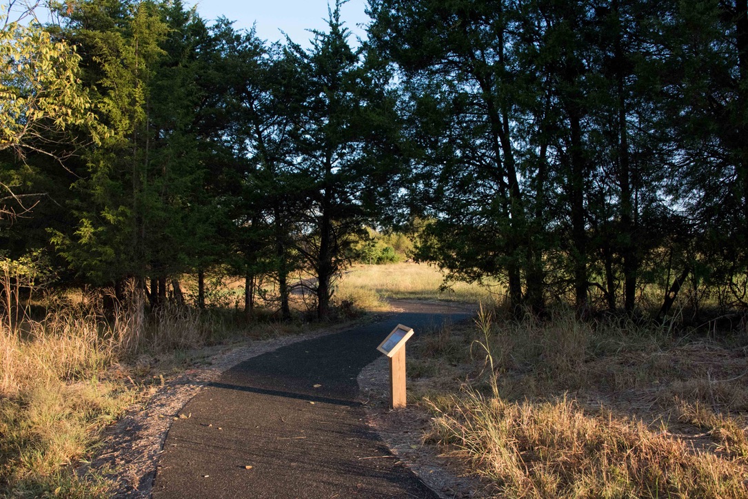
Virginia has a number of trails with minimal obstacles. Some are very easy and others are wheelchair accessible. Here are just a few of them.
These links were found through Internet search. I would love to have some first-hand recommendations. With your help, we can share our knowledge with disabled people everywhere and also increase awareness of the need for more accessibility. Please e-mail me with your suggestions using the form in the sidebar.
Federal
State
Local
Private
Miscellaneous
Federal
Assateague Island National Seashore
Assateague Island is a 37 mile long island along the coasts of Maryland and Virginia. Assateague Island Nat’l Seashore “… contains over 37 miles of pristine beach. More than 300 wild ponies wander the beaches, inland pine forest, and salt marshes.” “The Chincoteague National Wildlife Refuge is located on Assateague Island and is one of the most popular birding destinations in the United States. ” There are three visitor centers: Chincoteague NWR 757-336-6122, Tom’s Cove 757-336-6577, and Barrier Island 410-641-1441. Call the Assateague Island National Seashore Main Line: 410-641-1441 and dial #1 Maryland District Visitor Information to learn more. Here is the Park Service website. Here is another website for Assateague Is. Plan Your Visit Brochure
Page on Accessibility. Maryland Trail Map Virginia Trail Map There are rental beach wheelchairs.
Wheelchair accessible trails in the Maryland District include the Life of the Marsh Trail, the Life of the Forest Trail, and the Bicycle Bridge, all of them 1/2 mile long.
Wheelchair accessible trails in the Virginia District include Black Dutch Marsh Trail 1 mile, Toms Cove Visitor Center Boardwalk 1/8 mile, Wildlife Loop 3.2 miles, and Woodland Trail 1.6 mile.Back Bay National Wildlife Refuge
“Back Bay NWR includes a thin strip of barrier island coastline typical of the Atlantic and Gulf coasts, as well as upland areas on the west bank of Back Bay. Habitats include beach, dunes, woodlands, agricultural fields, and emergent freshwater marshes. ” The Refuge is just southeast of Virginia Beach.
Here is the Refuge website. Map Overview Map
Winter Trails Map Summer Trails Map phone 757-301-7329 x3106
Trails The seven trails listed here range in length from 0.1 to 3.15 miles and all are described as having a gentle grade (0 to 5%), with varied cross slopes.
Blue Ridge Parkway
The Parkway is a 469 mile drive “revealing stunning long-range vistas and close-up views of the rugged mountains and pastoral landscapes of the Appalachian Highlands.” The Blue Ridge Parkway is in both Virginia and North Carolina.
Here is their website. Phone 828-348-3400 Recorded Park Information line 828-298-0398
Parkway Visitor Center in Asheville, North Carolina 828-298-5330 Map Real time open/close road status map – AccessibilityThe Blue Ridge Parkway in Virginia
Peaks of Otter
Abbot Lake Trail One mile loop around the lake “…through a woodland forest and open field.
Trails in North Carolina This site gives mileage and a rating of easy, moderate or strenuous and links to trail maps. I can not tell just how easy is “easy” and there is no indication whether there might be obstacles such as stairs.
Rocky Knob
? Rocky Knob Picnic area trail “… is an easy 1-mile loop and offers a pleasant walk through a mature forest of large oaks, ashes, hickories, Fraser magnolias, hemlocks, and other native trees and shrubs.”George Washington and Jefferson National Forests
“The Jefferson National Forest is comprised of lands located in Virginia, West Virginia and Kentucky. The George Washington National Forest is comprised of lands located in Virginia and West Virginia.” Both of these Forests are primarily in Virginia. I am putting this one post in the pages for all three states. There are a ton of trails, many of them described as easy. You might pick an area you want to visit and call the appropriate Ranger District for advice. Here are phone numbers for the eight Ranger Districts. Supervisor’s Office Phone 540-265-5100. Links to Maps Day Hikes National Forests Foundation Here is the Forests’ website. Massanutten Storybook Trail in Lee Ranger District 0.5 miles described in Virginia Trail Guide. “…leads to a spectacular view overlooking the Blue Ridge Mountains and Shenandoah Valley. Learn from the interpretive signs of how the Massanutten Mountains were formed.”
 Lions Tale Accessible Trail for the Visually Impaired in Lee Ranger District 0.5 mile interpretive loop. Waymarking.com Backpacker.com “Listen to the gentle ripples of Passage Creek, feel the refreshing water running from the flume, and smell the sweet aromas of sassafras and birch.”
Pandapas Pond Loop Trail Eastern Divide Ranger District 0.9 mile “The pond is situated in a hardwood forest. Rhododendron and flame azalea are abundant. … The trail encircles both the pond and the adjacent wetland.”
Fenwick Nature Walk Trail Eastern Divide Ranger District. 1.0 mile. “…hikers can walk through an Appalachian forest, cross Mill Creek, pass through swampy wetlands, and get a nice view of a scenic waterfall. Wildflowers are abundant during the spring.”
Virginias Walk Trail Eastern Divide Ranger District 1.30 miles. “This 1.3 mile nature trail meanders around White Rocks Campground.”
Rhododendron Trail James River Ranger District. 0.12 miles There is a “…wonderful view of the Rich Hole Wilderness at the end.”
Beartree Lake Trail Mount Rogers National Recreation Area 0.8 miles paved and gravel-surfaced trail which encircles Beartree Lake.
Jackson River Fishing Trail Warm Springs Ranger District 0.85 miles. Primarily used for fishing access to the Jackson River, the trail follows an old roadbed and has scenic views of the river.
Hidden Valley West Trail in Warm Springs Ranger District 1.08 miles. Follows the Jackson River downstream.Manassas National Battlefield Park
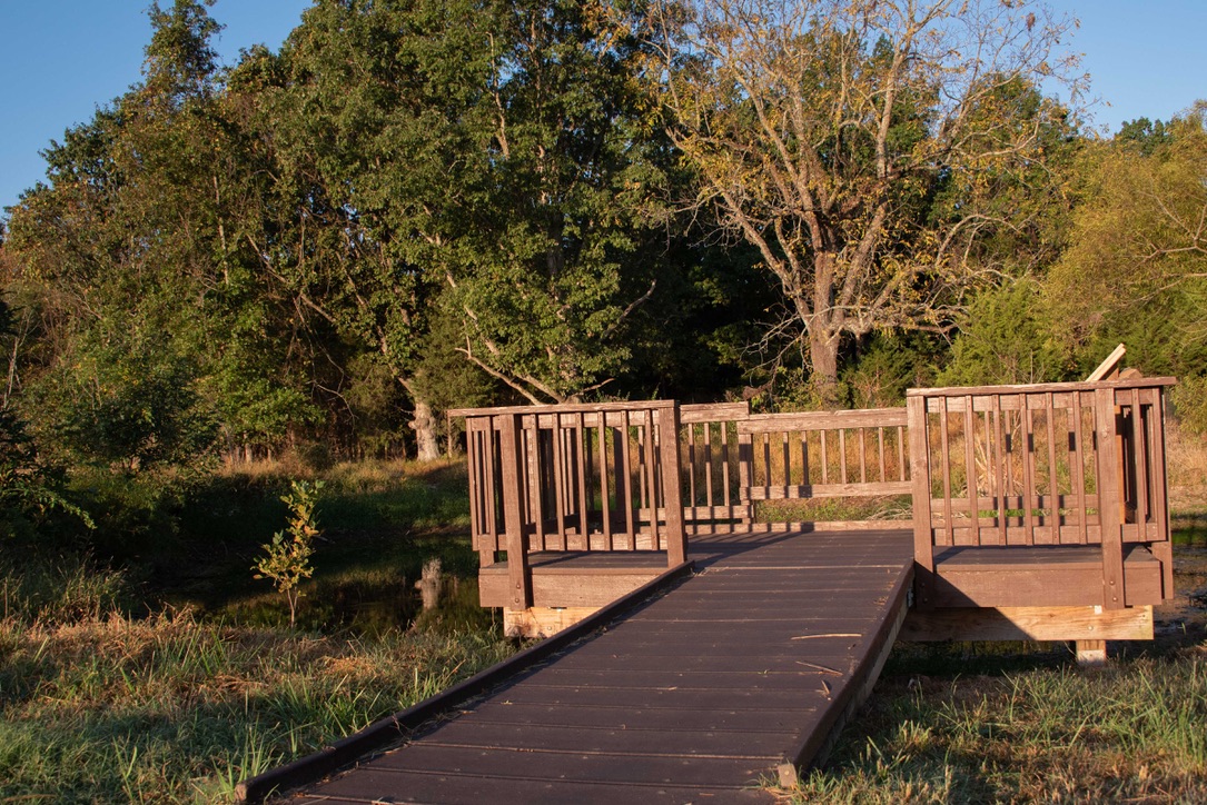
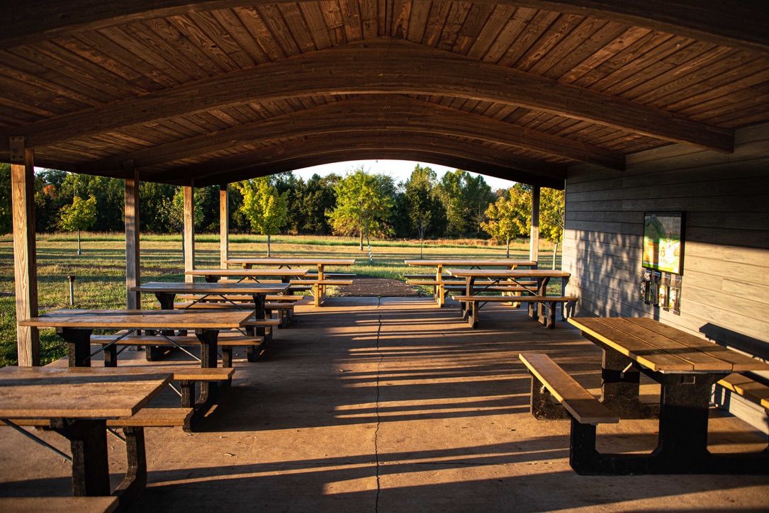
Mantissas National Battlefield Park’s 4,400 acres acres are “characterized by gently rolling hills with a patchwork of open fields and forests.” Audubon Society has named it a Northern Virginia Birding Hotspot. “The park has developed a series of loop trails that traverse key areas of the First and Second Manassas Battlefields. ” Thank you to Bryan Gorsira with the Park Service who wrote to tell me of new accessible trails at Manassas. From Bryan: “The Brownsville picnic area is located in the south western portion of the park and has a large parking lot, accessible restroom facilities, and a covered pavilion with accessible picnic tables, and a ¼ mile wheelchair accessible natural resource education trail. ”
Here is the Park website. Phone 703-361-1339 Accessibility Trail Map
For a detailed description of the trails see National Park Planner.
 Brownsville Picnic Area Loop 0.25 mile “This trail is a gently rolling hard surface loop trail that leaves from the pavilion and restrooms, though fields and near a stream, past a small pond with a wheelchair accessible dock, and back to the pavilion.”
The Stone Bridge Trail is about 400′ and goes to an overlook with wayside markers at the bridge.
Chinn Ridge Trail 0.5 mile ADA paved extends along the crest of Chinn Ridge with several interpretive markers focusing on the Second Battle of Manassas.
Brawner Farm Trail about 800′ and provides access to the Brawner Farm.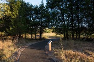
Accessible Brownsville Picnic Area Loop, ©Manassas Battlefield Nat’l Park 
Accessible Fishing Dock ©Manassas Battlefield National Park 
Accessible Pavilion @Manassas Battlefield National Park Mason Neck National Wildlife Refuge
Elizabeth Hartwell Mason Neck National Wildlife Refuge …. “provides wildlife a relatively remote area of upland forests and freshwater marshes extending into the Potomac River. The Refuge habitats host over 211 bird species, more than 200 plant species, 31 mammal species, and 40 species of reptiles and amphibians.”
Here is the Refuge website. Phone 703/490-4979 Map Brochure
Joseph V. Gartlan Great Marsh Trail 0.75 mile paved trail “…following a forested peninsula and ending at an observation platform overlooking the Great Marsh.”
High Point Trail 3 mile This ADA compliant paved trail parallels High Point Road and connects the refuge with Mason Neck State Park managed trails and facilities.
 ? The 3 mile Woodland Loop Trail looks as though it might be easy, but does cross some streams. Call to learn more.
Shenandoah National Park Phone 540-999-3500 Accessibility Park Map Maps
Limberlost Trail 1.3 miles loop. Map AllTrails Kids in Parks There are benches and over 20 resting areas on this trail which passes through forest and mountain laurels.
? Story of the Forest Trail 1.9 mile loop Self-guided nature tour. alltrails.com hikingproject.com
State
Virginia State Parks Accessibility statement. The website states that there are 16 accessible trails amounting to 12 miles. For information, contact the State Parks Customer Service Center at 800-933-7275 or the individual parks.
Each park’s website has a thorough description of accessibility. You can find it by clicking on “Other info” from the home page.
The Trail Guides for the parks list many trails listed as “easy”. Their definition of easy is : “From .5 to 1 mile; grades are short, typically fewer than 100 feet and less than 10 percent of the trail length; easily accomplished by all users, including the elderly and those with physical or mental disabilities, with little risk of injury or fatigue”. There are too many of these trails for me to list here, but if you have some favorites, please let me know and I will add them.
Search by Amenities This webpage lets you search through the state parks using the features that you want.Bear Creek Lake State Park
In “…the heart of the Cumberland State Forest in central Virginia, Bear Creek Lake is less than an hour west of Richmond. It’s the perfect getaway for the outdoor enthusiast. Activities center on the 40-acre lake with a boat launch, fishing pier, boat rentals and a swimming beach.”
“Although motorized vehicles are not permitted on park trails, power-driven mobility devices for those with disabilities are permitted. Check with park staff to see if a given mobility device is suitable for a particular trail.”
Here is the Park website. Accessibility Phone 804-492-4410 Trail Guide
Coyote Trail 0.07 mile Otter Trail 0.16 mileBeaver Run Trail 0.05 mileBelle Isle State Park
“Belle Isle has seven miles of shoreline on the Northern Neck’s Rappahannock River and provides access to Mulberry and Deep creeks. The park lets visitors explore a wide variety of tidal wetlands interspersed with farmland and upland forests.” There are twelve trails, all of them rated “easy”. I am just listing a few of them. You might want to call ahead to be sure of conditions.
Trail Guide Phone 804-462-5030 Here is the Park website. Accessibility
Mulberry Creek Boardwalk 0.17 mile has an observation deck and an accessible fishing pier.
Bluebird Trail 0.9 mileBrewers Trail 0.53 mileNeck Fields Look Trail 1.19 mileWhite Oak Swamp Loop 0.58 mileDeep Creek Trail 0.9 mileFirst Landing State Park
First Landing State Park is a National Natural Landmark and is listed in the National Register of Historic Places. “As Virginia’s most-visited state park, it’s an oasis within urban Virginia Beach. The park has 20 miles of trails and 1.5 miles of sandy Chesapeake Bay beach frontage. First Landing offers many recreational and educational activities and has many unusual habitats including bald cypress swamps, lagoons and maritime forest, as well as rare plants and wildlife.”
Here is the Park website. Accessibility Trail Guide Phone 757-412-2300
Descriptions of the Trails
Live Oak Trail 0.4 mile “The terrain is mostly flat; the ground is packed sand and dirt with small patches of beach-like sandy areas. Trail users often see and hear snakes, reptiles, and woodpeckers and other birds.”
“The Cape Henry Trail is universally accessible from Kendall to 64th Street.”High Bridge Trail State Park
“The park’s centerpiece is the majestic High Bridge, which is more than 2,400 feet long and 125 feet above the Appomattox River.”
Here is the Park website. Accessibility Phone 434-315-0457 Trail Guide
All the ten trail sections are described in the guide as easy. This 31 mile long rail/trail is “…..wide, level and generally flat. Its finely crushed limestone surface and dimensions make it easy to enjoy.” This park came up in my search for universally accessible trails in Virginia State Parks, but there is no mention of such use on this website.
“Rangers at the park offer accessibility tours throughout the year to help disabled persons access High Bridge. Reservations are required. Call 434-315-0457 or email highbridgetrail@dcr.virginia.gov.”Hungry Mother State Park
Hungry Mother State Park is “…known for beautiful woodlands and a placid 108-acre lake in the heart of the mountains. The park has a sandy beach with bathhouse, boat rentals (fishing, canoe, kayak, paddle boats and paddle boards), a boat launch and a universally accessible fishing pier. “
Here is the Park website. Accessibility Phone 276-781-7400 Trail Guide
Lake Loop Trail 1 mile is easy “This loop trail starts and ends at 2,212 feet. The first mile, which parallels Park Blvd., is gently rolling and relatively flat. Once the trail crosses the dam, it begins steeper rolling sections.”James River State Park
“Nestled in the foothills of the Blue Ridge Mountains, the park features rolling grasslands, quiet forests and beautiful views, as well as 3 miles of shoreline along the James River. “
Here is the Park website. Accessibility Phone 434-933-4355 Trail Guide
Green Hill Pond Loop 0.37 mile “About half the trail is a boardwalk over water, allowing guests to fish and enjoy nature from a different perspective. The trail has an ADA-accessible floating fishing dock.”
Tye River Overlook 0.11 mile “Those with disabilities should contact a park ranger for permission to drive to the start of the Tye Overlook Trail. ”
River Trail 3.1 miles “This trail, beside the James River, offers views of the river and runs between the river and a wetland.”
Cabin Loop 0.8 milesTaylor Pond Loop 0.25 mileKiptopeke State Park
“Located on Virginia’s Eastern Shore, this park offers recreational access to the Chesapeake Bay and the chance to explore a unique coastal habitat featuring a major flyway for migratory birds.” A free beach wheelchair is available on request. “The fishing pier is ADA-accessible up to the fishing-cleaning station. The pier has a firm surface of dirt, gravel and grass.”
Here is the Park website. Phone 757-331-2267 Accessibility Trail Guide
Bald Eagle Bluff 0.1 mileLeesylvania State Park
Leesylvania State Park, nestled along the tidal shores of the historic Potomac River, “…offers many land and water activities, including hiking, picnicking, fishing and boating.” There is a universally accessible fishing pier.
Trail Guide Phone 703-730-8205 Here is the Park website. Accessibility
Potomac Trail 0.41 mileBushey Point Trail 1.81 mile described as “Partially accessible”.Mason Neck State Park
Close to Washington, D.C., …”this Northern Virginia park offers many outdoor activities and programs. It has hiking trails, 3 miles of paved multi-use trails, a large picnic area…and a visitor center. ….The park’s wetlands, forest, open water, ponds and open fields make it ideal for environmental study and wildlife observation. ”
Trail Guide Here is the Park website. Accessibility Phone 703-339-2385
Beach Trail 0.3 mileDogue Trail 0.9 mileHigh Point Multi-use Trail 3 milesMarsh View Trail 0.25 mile
Local
Arlington County
Arlington County has a great many parks. Use their Find a Park to filter parks by Amenities such as paved trails or accessible restrooms. They describe paved trails and rate some as easy, but wheelchair accessibility is not mentioned. Call Parks and Recreation phone 703-228-7529 for more information.
Map of Parks and Off Street Trails Trail Descriptions
Lubber Run Park Map from Live and Let Hike
Lubber Run Trail 1.2 miles round trip. Paved, but with a few somewhat steep places.
Dawson Terrace Park Phone 703-228-1875 Trail Map
?Palisades trail 0.43 miles is rated “Easy to moderate”. “…a relaxing walk in the forest featuring ancient tulip poplar trees and views of the Potomac.”
Fort C. F. Smith Park Map
? The trail is 0.46 miles and rated easy. The surface is “….variable and is asphalt, concrete & gravel.” It is not listed as wheelchair accessible, but you might want to give the county parks a call.
Glencarlyn Park?? Map There is no specific information about the trails at this park other than they range from difficulty from “easy to difficult” and include nature trails.
Lacey Woods Park Map
0.34 mile “Trails through Lacey Woods offer a small escape from an urban environment. You will find mature trees, an azalea garden, and an active group controlling invasive plant species. You may even come across red salamanders who make their home among the logs here.”
Rock Spring Park Map
0.29 mile of a paved, easy trail. “Bridges cross the wooded stream at several locations and bring you closer to nature. Local gardeners have made enhancements here, and several volunteers including students from Nottingham School help to preserve the natural beauty.”
Thrifton Hill Park Map
? 0.39 mile Rated “easy to moderate” “…a pleasant walk through woods and open spaces perfect for taking a break. This passive park features a paved path and natural trail.”
Tuckahoe Park Map
0.47 mile easy. “…a refreshing and informative walk as you read the interpretive panels about nature. You will enjoy the wetland garden, forest, playground, and picnic area.”
Zachary Taylor Park Map
? One mile “easy to moderate” stone dust rail. “…a beautiful place to enjoy being outside with nature trails, paths and a stream.” City of Virginia Beach
“Virginia Beach is home to 293 parks and park facilities, encompassing over 7,000 acres, including neighborhood and community parks, metro parks, signature parks, natural areas, waterway accesses, trail linkages, open space preservation areas and park athletic facilities.”
Here is the website for Virginia Beach Parks and Natural areas. Phone 757-385-0400 Trails Map
West Creek Natural Area “This natural area has been kept in its natural state with the exception of a series of shared use trails that total approximately 2.5 miles of soft path and .3 miles of paved ADA compliant trails. The trail system borders West Neck Road to the west and Princess Anne Road to the north.”Fairfax County
The county’s “Trail Buddy” is an interactive map which allows you to click on a trail to see its name, surface, and width. You can access this map with a smartphone: http://bit.ly/fairfaxtrailbuddy Difficulty is not mentioned, but many of these trails are paved.
Trails Information and links to maps Major Parks Fairfax County Park Authority phone 703-324-8702 Park Authority website.
Lake Accotink Park 703-569-3464 has a 3.9 mile rail trail which TrailLink.com describes as wheelchair accessible.
Lake Fairfax Park 703-471-5415 Map of trail system Most of the trails shown on the map are labeled “easiest”. Better call first to be sure.
Ellanor C. Lawrence Park Phone 703-631-0013 Map
? “There are approximately four miles of trails …. located in upland and bottomland forest and along the meadows. The trails are used for hiking, bird watching, jogging and walking. ” Difficulty is not given for these trails.
Huntley Meadows Park Phone 703-768-2525 “…a 1500-acre nature preserve that includes forests and regionally-rare marsh wetlands. It provides some of the best wildlife watching in Fairfax County.”
? The park has a 1/2 mile wetland boardwalk trail and a two mile “interpretive trail system.” The website gives no difficulty ratings for these trails, but StrollerFriendly Trails in Northern Virginia describes them as, “ADA-compliant, stroller friendly trails pass through the woods to a long boardwalk over the beautiful marsh.”City of Hampton
Here is the website for Hampton Parks & Recreation.
Sandy Bottom Nature Park
“From the 10,000 square foot nature center overlooking Sandy Bottom Lake to the elusive creatures that inhabit the wetland marshes, there is something for everyone at Sandy Bottom Nature Park.”
Here is the Park’s website. Phone 757-825-4657 Park Map Brochure There are numerous trails in this park which are easy and probably more than these three are accessible. AllTrails describes them as wheelchair friendly.
Trillium Loop Trail 4.5 milesMatteson Trail 4.4 miles It loops around the outside of the Hamptons Golf Course and is heavily used.
Chrisman Lake Trail 0.8 mileHenrico County
“We are pleased to offer our citizens a variety of programs and activities for all ages, including residents with special needs. From visual arts to nature and outdoors, preschool to senior adults, there is something for everyone!”
Here is website for Henrico County Recreation and Parks. RichmondOutside
Three Lakes Park & Nature Center Phone 804-652-1470 Park Map
The Park’s 1. 3 miles of trails circle three man-made lakes. AllTrails says it is “wheelchair friendly”.
Private
Blue Ridge Center
Blue Ridge Center preserves 900 acres of Virginia’s Piedmont, including streams flowing into the Potomac, diverse plants, sustainable farming and wildlife ranging from “butterflies to bears.” The 10 mile network of trails wind through forests and meadows.
Here is the Center website. Phone 540-668-7640 Trail Map Hiking
Farmstead Loop “Just over a mile long and with minimal elevation change, the trail is perfect for all ages and fitness levels.”Rockfish Valley Foundation
The Foundation works to preserve the natural, historical, ecological and agricultural resources of the Rockfish Valley. They support the Rockfish Valley Loop Trail system, Spruce Creek Park and the lands associated with them.
Natural History Center phone 434-361-0217 RVF Office phone 434-226-0446 See also Rockfish River Loop Trail Here is the Foundation’s website.
Trail Map
Rockfish Valley Track Trail From Kidsinparks.com “…. a flat, 1 mile loop that follows the South Fork of the Rockfish River and Reids Creek. The trail features riparian, field, and bog habitats and offers excellent opportunities for viewing wildlife.”
? There are plans for a the Native Plant Walk. I don’t know if this has been completed. From the map it looks very easy.
Spruce Creek Park
This park in Nelson consists of 35 acres located at the intersection of Rt. 151 and Glenthorne Loop. It contains the Rockfish Valley Foundation Natural History Center and three trails: The Children’s Nature Trail, the Butterfly Trail, and a birding trail. Difficulty ratings for these trails are not given. Call ahead.Ni River Trail
The Ni River Trail is an easy and partially wheelchair accessible trail near Fredericksburg, Virginia. It is maintained by the Spotslyvania Greenways Initiative. Location as described on Fredericksburg.com is “behind River Run Business Park off U.S. 1, across from Massaponax High School. It’s on land owned by Luck Development Partners and has a half-mile handicapped-accessible path covered with stone dust. ”? The Salamander Loop of the Ni River Trail is about 2 miles long and loops past a wetland area and an old farm pond and includes an overlook of the Ni River basin. Local fauna include deer, beavers, foxes, birds and salamanders. Thank you to Bill Blevins for this description, “…Open to public. Fairly well groomed and wide trail through the woods. Many labeled trees along the path. There is a short loop and a longer loop with a spur trail along the river when it is not hunting season. I would say not accessible to wheelchairs but it is easily walked. There are 6 designated parking spots at the trailhead.” Here is a description by Plants Map. Video
Miscellaneous
Accessible Trails from the Christopher & Dana Reeve Foundation’s website
Accessible Virginia is a private Website maintained by the Duke Family. It collects information for a variety of accessible locales, including National and State parks, private parks, and other places of interest to the outdoor enthusiast.
AllTrails Best Wheelchair Friendly Trails in Virginia A list of 83 trails deemed wheelchair friendly by AllTrails.com
AllTrails Map of Trails in DC area Difficulty and rating given for 137 trails in Virginia and Maryland surrounding the District of Columbia.
Nature For The Blind has a directory of Braille trails for almost every state in the US and for many other countries.
Northern Virginia Nature Centers Article from Northern Virginia Magazine, 9/4/2015
There are many nature centers in northern Virginia and many of these have nature trails. The websites to these centers rarely give any indication of the trails’ difficulty or accessibility. This article not only gives links to the centers, it provides phone numbers so you can call to inquire about a trail’s suitability for you.The Rails-to-Trails Conservancy lists wheelchair accessible trails in Virginia.
Stroller Friendly Trails of Northern Virginia “…round-up of stroller friendly trails in Northern Virginia highlights paths that are easy to navigate and provide interesting diversions whether you’re inside or behind the stroller. Most of the paths are paved but we’ve also included dirt trails that are navigable with a sturdy stroller.”
Wheelchairtraveling.com is an outstanding resource.